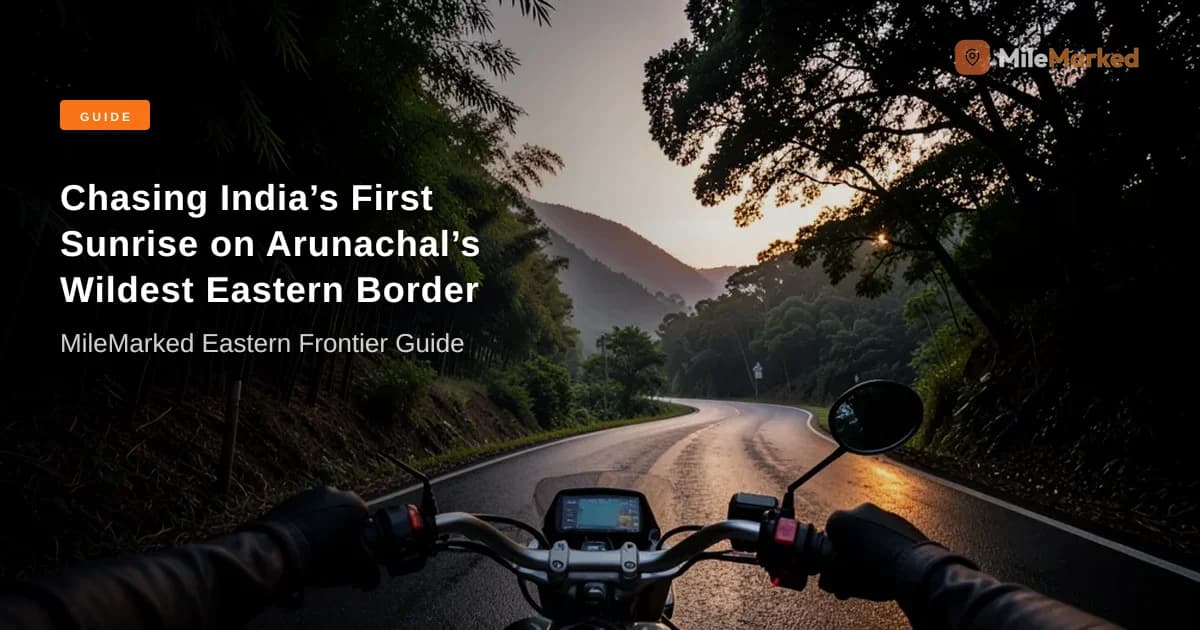
Imagine standing at an elevation of 1,240 meters at 4:30 AM in complete silence, watching golden rays slice across an eastern Himalayan ridge as you become the very first person in a nation of 1.4 billion people to greet the morning sun. This isn't just another mountain ride; it is a 1,200 km round-trip frontier pilgrimage into Arunachal Pradesh's remote Anjaw district. If you are looking for a complete walong to dong valley ride guide, this article delivers the exact, battle-tested intelligence you need to navigate active landslide zones, border clearances, zero-connectivity stretches, and the intense 2:00 AM night trek to Dong Krong.
Quick Summary:
- Total Route Distance: ~1,200 km round-trip from Dibrugarh/Tinsukia via Tezu, Hayuliang, Walong, and Kaho.
- Mandatory Permit: Arunachal Pradesh Inner Line Permit (eILP) costing ₹400 for Indian nationals.
- Critical Fuel Warning: The absolute last operational fuel station is at Khupa (~4 km before Hayuliang). You must carry a minimum of 10 litres of spare fuel in jerry cans to cover the remaining 200+ km loop.
- Dong Krong Sunrise Trek: Starts strictly at 2:00 AM from the Lohit River iron suspension bridge; requires a local Meyor tribal guide (₹500 standard fee) and high-lumen headlamps.
- 2026 Infrastructure Status: The restored Karoti Bridge (KKG-BSB) is open to light vehicles, and double-laning work on NH-113 continues near Tidding.
Verified by MileMarked · Last verified: October 2026
Walong to Dong Valley: India's Easternmost Ride Guide for Adventurers
To ride from Walong to Dong Valley, secure an Arunachal Inner Line Permit (₹400) online prior to departure. Fill up your main tank and top off at least 10 litres of spare fuel in metal jerry cans at Khupa, as no commercial fuel pumps exist beyond this point. From Walong, ride 7 km north to the iron suspension bridge over the Lohit River, cross on foot, and begin the steep 2:00 AM trek to the Dong Krong ridge viewpoint with a local Meyor guide (₹500 fee) to witness India's earliest sunrise at approximately 4:30 AM.
Riding into the Lohit Valley isn't like touring Himachal or Ladakh. Out here, smooth tarmac can instantly dissolve into raw mud slips, cell service vanishes for days at a time, and the Line of Actual Control (LAC) is just a short throttle twist away. Walong holds deep historical significance as the site of the fierce 1962 Sino-Indian War battle, where Indian soldiers held off overwhelming forces in high-altitude defense. Today, it serves as the ultimate basecamp for adventure motorcyclists targeting Dong Valley, Kaho (India’s first village on the border), and Kibithu.
+-----------------------------------------------------------------------------------+
|                            ROUTE OVERVIEW SCHEMATIC                               |
|                                                                                   |
|  Tinsukia/Dibrugarh  --->  Tezu (180 km)  --->  Hayuliang / Khupa (100 km)         |
|                                                     |                             |
|                                             [LAST FUEL PUMP]                      |
|                                                     v                             |
|  Kaho / Kibithu  <---  Dong Suspension Bridge  <---  Walong (100 km)               |
|  (LAC Border)           (Start 2 AM Trek)                                         |
+-----------------------------------------------------------------------------------+
Essential Route Logistics: Distances, Terrain, and Anjaw District Road Conditions 2026
Navigating the 225 km stretch from Tezu to Walong and onward to Kaho requires a realistic understanding of Anjaw district road conditions 2026. While the National Highways and Infrastructure Development Corporation Limited (NHIDCL) has made significant strides under the Trans-Arunachal Highway initiative, the terrain remains inherently dynamic.
The section between Tidding and Arrowa along NH-113 continues to be an active landslide zone during wet spells. Rider data from late 2026 confirms that the restored Karoti Bridge (KKG-BSB) at Krowti is fully functional, allowing motorcycles and light vehicles uninterrupted access across the Lohit River toward Dong Valley and Kibithu. However, double-laning construction between Khupa and Hayuliang creates fine dust bowls during dry days and thick slush after rain.
| Route Segment | Distance (km) | Terrain & Road Type | 2026 Status & Conditions |
|---|---|---|---|
| Tezu to Hayuliang | ~100 km | Mixed tarmac & mud bypasses | Active NH-113 widening; steep climbs around Tidding gap |
| Hayuliang to Walong | ~100 km | Single-lane BRO asphalt, gravel | Restored Karoti Bridge open; narrow shelf roads above Lohit River |
| Walong to Dong Bridge | ~7 km | Broken tarmac & concrete patches | Good condition; clear signage leading to river crossing |
| Walong to Kibithu/Kaho | ~35 km | Border road asphalt & hairpins | High military traffic; excellent tarmac with occasional rockfalls |
Understanding the Anjaw Terrain
The ride follows the gorge carved by the roaring Lohit River. As you gain elevation beyond Tidding, the curves become tighter, the drop-offs steeper, and the road shelf narrower. Blind hairpins are frequent, and heavy military truck convoys always claim the right of way. I strongly advise keeping your speed below 40 km/h on single-lane shelf roads—one misjudgment on loose gravel can send a bike over a 300-meter cliff into the torrent below.
📋 Complete Walong to Dong Valley Planning Kit on MileMarked This route has a verified day-by-day itinerary, mapped fuel stops, hotel suggestions for every night, break points, and a downloadable packing checklist. Visit the Walong to Dong Valley Bike Trip trip page on MileMarked to download the complete planning kit — it's everything you need before you leave home.
Permits Demystified: Arunachal Pradesh ILP for Bikes and Border Clearances
Obtaining an Arunachal Pradesh ILP for bikes is an absolute legal mandate for all Indian citizens entering the state. You will not be allowed past the border check-posts at Dirak or Demwe without a valid Inner Line Permit document.
   +----------------------------------------------------------------+
   |                  ILP & CLEARANCE WORKFLOW                      |
   |                                                                |
   |  [Online Portal] Apply at arunachalilp.com (eILP: ₹400)        |
   |                         |                                      |
   |                         v                                      |
   |  [Check-post 1] Demwe / Dirak Gate (Physical Verification)     |
   |                         |                                      |
   |                         v                                      |
   |  [Check-post 2] Hayuliang Army / Police Gate (Details Logged)  |
   |                         |                                      |
   |                         v                                      |
   |  [Check-post 3] Walong Army Base (Border Area Log Entry)       |
   +----------------------------------------------------------------+
Step-by-Step eILP Process for Indian Nationals
- Access the Official Portal: Apply strictly through the official Arunachal eILP portal (
arunachalilp.com). Avoid third-party agents charging inflated fees. - Select District & Circuit: Select Anjaw District (Tezu - Hayuliang - Walong - Kibithu circuit).
- Upload Documents: You need a scanned passport-size photo, a valid photo ID (Aadhaar Card or Voter ID), and vehicle registration details.
- Pay Fee: Pay the standard processing fee of ₹400 per applicant for standard processing (usually approved within 24 to 48 hours).
- Print Physical Copies: Carry at least 3 hard copies of your approved eILP. Military check-posts near border zones do not accept digital PDFs on phones due to zero network connectivity.
Foreign Passport Holders: Foreign nationals cannot enter Anjaw district on a standard ILP. They require a Protected Area Permit (PAP), issued only to groups of two or more people through registered Arunachal travel operators approved by the Ministry of Home Affairs.
Military Check-Post Formalities
As you approach the border zone beyond Hayuliang, you will encounter multiple army and police verification points at Demwe, Hayuliang, and Walong. At each post:
- Park your motorcycle clear of the roadway.
- Present your driver's license, bike RC, insurance, emission certificate, and paper eILP copy.
- Sign the physical entry register noting your vehicle registration, destination, and mobile number.
- Always address personnel with respect; remember, these posts operate in sensitive Line of Actual Control (LAC) border regions.
Fuel Strategy & Cash Requirements: Surviving the Khupa Fuel Station Gap
If there is one piece of advice in this walong to dong valley ride guide that could save your trip from ending in total disaster, it is this: the absolute last operational commercial fuel station before Dong Valley is located at Khupa (~4 km before Hayuliang).
+-----------------------------------------------------------------------------------+
|                               THE 200 KM FUEL DEAD ZONE                           |
|                                                                                   |
|   Khupa Fuel Station  ------------------------------------> Walong & Dong Valley   |
|   [FILL MAIN TANK + 10L]       NO COMMERCIAL PUMPS          [NO FUEL STATIONS]   |
|                                  <--- 200+ KM --->                                |
+-----------------------------------------------------------------------------------+
Beyond Khupa, there are zero official petrol pumps in Hayuliang, Walong, Dong, Kibithu, or Kaho. The distance from Khupa to Walong, onwards to Kaho/Kibithu, and back to Khupa is roughly 240 km. However, accounting for steep Himalayan climbs in lower gears, idling during cold starts, and potential road blockages, your fuel consumption will spike by 30-40%.
Mandatory Spare Fuel Calculations
- Main Tank Fill: Top off to maximum capacity at Khupa Indian Oil pump.
- Auxiliary Fuel: Carry a minimum of 10 litres of fuel in high-density polyethylene (HDPE) jerry cans or dedicated metal fuel containers securely strapped to your pannier racks.
- Do NOT use plastic water bottles: The rough terrain and altitude-induced pressure changes will cause soft plastic bottles to crack, leak onto your luggage, or create severe fire hazards near your hot exhaust.
Black-Market Fuel Realities
In emergency situations, local shops in Walong or Hayuliang occasionally sell petrol out of 2-liter soft drink bottles at ₹140–₹180 per liter. Avoid this unless absolutely desperate. This fuel is frequently adulterated with kerosene or contaminated with water and sediment stored in dirty drums, which can clog fuel injectors or ruin carburetor jets on high-performance adventure bikes.
The Cash Economy of Anjaw District
Digital payments (UPI, Paytm, Google Pay) and credit cards cease to function the moment you ride past Tezu. The last operational ATMs are located in Hayuliang (State Bank of India), but they are notoriously out of cash or offline due to satellite link failures.
Pro Tip: Withdraw at least ₹6,000 to ₹8,000 in physical cash (in ₹100 and ₹500 denominations) per rider while in Tinsukia or Tezu. You will need hard cash for homestays, meals, local guide fees, and emergency mechanical help.
Where is the Last Fuel Station Before Dong Valley?
The final reliable commercial fuel station before reaching Dong Valley is the Indian Oil petrol pump located at Khupa, situated approximately 4 km before you reach Hayuliang town on NH-113. Beyond Khupa, there are absolutely no official retail fuel stations across the entire 200-kilometer round-trip border circuit encompassing Walong, Dong, Kibithu, and Kaho. Riders must fill their tanks completely at Khupa and carry a minimum of 10 litres of spare fuel in certified jerry cans.
The Dong Krong Sunrise Trek: Timings, Gear, and Local Guides
To witness India first sunrise Dong Valley, you have to earn it. The village of Dong sits at an elevation of 1,240 meters, surrounded by snow-capped peaks and dense pine vegetation. However, the sunrise viewpoint isn't inside the village itself—it is located high on the Dong Krong ridge.
+-----------------------------------------------------------------------------------+
|                        DONG KRONG TREK TIMELINE & ELEVATION                       |
|                                                                                   |
|  01:30 AM: Wake up at Walong / Dong Homestay                                      |
|  02:00 AM: Cross Lohit River Suspension Bridge on foot                            |
|  02:15 AM - 04:15 AM: Steep 90-minute night ascent through pine forests           |
|  04:30 AM: Reach Dong Krong Ridge (1,240m) -> India's First Sunrise Hits Ridge    |
+-----------------------------------------------------------------------------------+
The 2:00 AM Trek Execution
- Starting Point: Ride from your Walong homestay (approx. 7 km) to the iron suspension bridge over the Lohit River near Dong village. Park your motorcycle securely in the small clearing near the bridge head.
- Bridge Crossing: Cross the roaring Lohit River on foot over the narrow suspension bridge using headlamps.
- The Night Ascent: The trek to the Dong Krong ridge is a continuous, steep 2-kilometer gradient through damp pine needles, rock steps, and tall grass. It takes most moderately fit individuals between 90 to 120 minutes.
- Timing the Sun: In Eastern Arunachal Pradesh, the sun breaks over the ridge line between 4:15 AM and 4:30 AM. To catch the exact moment the first light turns the snow peaks brilliant gold, you must begin climbing by 2:00 AM sharp.
Mandatory Trekking Gear
- High-Lumen Headlamp: Walking through a dense Himalayan forest at 2:30 AM in zero ambient light requires a hands-free headlamp (minimum 300 lumens) plus extra batteries.
- Footwear: Proper ankle-support trekking boots with deep tread lugs. Do not attempt this climb in flat riding boots or smooth sneakers; damp pine needles on steep slopes are extremely slick.
- Trekking Poles: Highly recommended to preserve your knees during the steep descent in daylight.
- Layering System: Temperatures at 4:00 AM on the ridge drop near freezing between October and February. Wear a moisture-wicking base layer, a fleece mid-layer, and a windproof outer jacket.
- Hydration: Carry a 1-liter thermal flask filled with warm water or hot tea.
Hiring a Local Meyor Tribe Guide
Navigating the forest trail in pitch darkness without a local is dangerous; offshoot cattle trails can easily lead you off cliffs. The local Meyor tribal community provides expert guide services.
- Standard Guide Fee: ₹500 per person (or ₹1,000–₹1,500 for a small group).
- Booking: Arrange your guide the previous evening through your Walong or Dong homestay host. Pay your guide in physical cash upon completion of the trek.
5-Day Verified Biking Itinerary & Cost Breakdown (INR)
Executing a successful Walong to Dong Valley bike trip requires a structured schedule that accommodates mandatory acclimatization, unpredictable road closures, and military clearance delays. Below is a battle-tested 5-day itinerary starting from Dibrugarh or Tinsukia.
+-----------------------------------------------------------------------------------+
|                            5-DAY FRONTIER ITINERARY                               |
|                                                                                   |
|  Day 1: Tinsukia/Dibrugarh  -->  Tezu (180 km / 5 hrs)                            |
|  Day 2: Tezu                -->  Walong via Khupa Fuel Stop (200 km / 8 hrs)      |
|  Day 3: Walong              -->  Dong Krong Sunrise Trek + Kibithu/Kaho Border    |
|  Day 4: Walong              -->  Hayuliang / Tezu (100–200 km / 6 hrs)           |
|  Day 5: Tezu / Hayuliang    -->  Return to Tinsukia/Dibrugarh                     |
+-----------------------------------------------------------------------------------+
High-Level Day Breakdown
- Day 1: Dibrugarh/Tinsukia to Tezu (180 km | ~5 hours): Cross the mighty Dr. Bhupen Hazarika Setu (Dhola-Sadiya Bridge). Complete ILP check-post formalities at Dirak/Demwe. Stay overnight in Tezu.
- Day 2: Tezu to Walong (200 km | ~8 hours): Tackle the steep curves of NH-113. Pass through Tidding and stop at Khupa to top off all fuel tanks and jerry cans. Cross the restored Karoti Bridge and arrive in Walong by afternoon.
- Day 3: Dong Sunrise Trek & LAC Border Circuit (60 km total riding): Wake at 1:30 AM for the Dong Krong sunrise trek. Return to Walong by 9:00 AM for breakfast. Ride north to Kibithu and Kaho, visiting India’s easternmost border posts along the Line of Actual Control.
- Day 4: Walong to Hayuliang / Tezu (100–200 km | ~6–8 hours): Begin your return journey down the Lohit Valley, navigating gravel bypasses and landslide zones at an easy pace.
- Day 5: Hayuliang/Tezu to Dibrugarh (180–280 km | ~6–8 hours): Return to the plains of Assam, completing the circuit.
Budget Estimation per Rider (Solo / Twin Sharing)
| Cost Category | Estimated Cost (INR) | Key Details & Advice |
|---|---|---|
| Inner Line Permit (eILP) | ₹400 | Official portal processing fee |
| Fuel (350cc–450cc Bike) | ₹3,500 – ₹4,500 | Based on ~1,200 km circuit + mountain consumption |
| Homestays & Lodging | ₹4,000 – ₹6,000 | 4 nights at basic basic homestays (~₹1,000–₹1,500/night) |
| Meals & Water | ₹2,500 – ₹3,500 | Simple, nutritious local dal, rice, eggs, and tea |
| Local Meyor Guide Fee | ₹500 | Standard rate for Dong Krong night trek |
| Emergency Contingency | ₹2,000 | Cash buffer for tire repairs or local transport |
| TOTAL ESTIMATED COST | ₹12,900 – ₹16,900 | Highly economical, frontier adventure budget |
Emergency Medical & Health Infrastructure
In remote frontier zones, medical facilities are basic. Do not expect advanced trauma care in the Lohit Valley.
- Hayuliang Community Health Centre (CHC): 16-bed facility with basic emergency stabilization.
- Walong Primary Health Centre (PHC): 6-bed facility managed by local government medical officers and supported by Indian Army medical units in emergencies.
- Rider Advice: Carry a personal medical kit containing broad-spectrum antibiotics, pain relievers, rehydration salts (ORS), band-aids, burn creams, and antiseptic solutions.
📋 Download the Complete Walong to Dong Valley Planning Kit Ready to execute this ride? Don't rely on fragmented online guides. Visit the Walong to Dong Valley Bike Trip trip page on MileMarked to download verified offline route tracks, fuel station waypoints, homestay contact lists, and packing templates built specifically for Indian adventure motorcyclists.
Rider's Survival Checklist: Best Time to Visit Dong Valley for Motorcycle Trip and Gear
My stance on riding gear for Eastern Arunachal Pradesh is firm: ditch lightweight mesh jackets in favor of heavy-duty windproof, waterproof textile riding gear with thermal liners. Many online riding guides suggest standard summer mesh armor because Assam is hot. I strongly disagree. The moment you enter the Lohit Valley river gorges beyond Tezu, wind chill combined with high humidity creates freezing conditions, especially during early morning transit to the trek starting point.
+-----------------------------------------------------------------------------------+
|                              RECOMMENDED GEAR SETUP                               |
|                                                                                   |
|  [UPPER BODY]  Textile Waterproof Outer Shell + Removable Thermal Liner            |
|  [LOWER BODY]  Riding Trousers with CE Knee Armor + Waterproof Inner Liner         |
|  [FOOTWEAR]    Waterproof Touring Boots (On Bike) / Trekking Boots (In Luggage)   |
|  [LUGGAGE]     100% Waterproof Dry-Bags / Strapped Saddlebags                      |
+-----------------------------------------------------------------------------------+
Best Riding Months
The ideal window for a best time to visit Dong Valley for motorcycle trip search is strictly between October and April.
- October to November: Crystal clear skies, mild temperatures, dry roads, and magnificent mountain clarity. Best window for photography and night treks.
- December to February: Crisp, cold weather with clear views. Cold morning starts; thermal gear is non-negotiable.
- March to April: Spring blooming season, pleasant temperatures, but increasing chances of pre-monsoon showers.
- AVOID May to September (Monsoon Season): The Lohit Valley receives torrential rainfall. Flash floods, severe mudslides between Tidding and Hayuliang, and washed-out bridges render the route treacherous and often impassable for motorcycles.
Critical Motorcycle Preparation
Before leaving Tinsukia or Dibrugarh, perform a thorough mechanical audit of your bike:
- Suspension Setup: Increase rear preload settings to handle additional luggage and spare fuel weight over rough washboard gravel.
- Tubeless Tire Setup: Ensure tires have plenty of tread depth. Carry a tubeless tire puncture repair kit, a compact 12V electric air inflator, and a manual hand pump as backup.
- Drive Chain Care: Dust from construction zones mixed with river silt destroys dry drive chains fast. Clean and lube your chain every 250 km.
- Spare Parts: Carry spare clutch and brake levers, a throttle cable, spare fuses, engine oil (1 liter for top-ups), and quick-setting epoxy/M-seal for crankcase protection.
Tribal Cultural Etiquette & Military Protocols
- Meyor & Mishmi Tribes: Respect local tribal customs. Always ask for permission before photographing village elders, homestays, or private property.
- Photography Restrictions: Strictly refrain from photographing military check-posts, artillery encampments, radar installations, bridges, or army personnel near the Line of Actual Control in Kibithu and Kaho.
Ready to ride Walong to Dong Valley? Don't leave home without the complete MileMarked planning kit — verified fuel stops, hotel recommendations, break points, and a packing checklist built specifically for this route. Riders who plan with MileMarked data ride smarter and worry less. Visit the Walong to Dong Valley Bike Trip trip page to download it now.
About the Author
Parth Kapoor is the founder of MileMarked and has been riding motorcycles across India since 2019. He has personally verified routes from Ladakh to Tamil Nadu, logging over 40,000 km on Indian highways and mountain passes. Parth built MileMarked after getting lost on the Spiti circuit with an outdated itinerary — his mission is to make sure no rider makes the same mistake.
Frequently Asked Questions
Where is the last fuel station before Dong Valley?
The absolute last operational commercial fuel station before Dong Valley is located at Khupa (~4 km before Hayuliang town on NH-113). There are no retail petrol pumps in Walong, Dong, Kibithu, or Kaho. Riders must fill their main tanks at Khupa and carry a minimum of 10 litres of spare fuel in proper jerry cans to complete the 200+ km border loop safely.
How to get an Inner Line Permit (ILP) for a Dong Valley bike trip?
Indian nationals must apply online via the official Arunachal Pradesh eILP portal (arunachalilp.com). Select Anjaw district (Tezu-Hayuliang-Walong circuit), upload a photo, Aadhaar/Voter ID, and vehicle registration details, and pay the ₹400 processing fee. Always print at least three physical hard copies of the approved permit, as military check-posts in zero-network areas require physical paper documentation.
How hard is the trek to Dong Krong sunrise viewpoint?
The Dong Krong sunrise trek is moderate to steep, covering approximately 2 kilometers of continuous uphill gradient through pine forests and grassy slopes. It takes 90 to 120 minutes of steady climbing in total darkness (starting at 2:00 AM). Hikers should possess basic physical fitness, wear sturdy trekking boots with good ankle support, carry high-lumen headlamps, and hire a local Meyor tribal guide (standard fee ₹500/person) for navigation safety.
Can I complete the Walong to Dong Valley ride on a 150cc motorcycle?
Yes, a 150cc motorcycle can complete this route, provided it is mechanically sound and properly geared. However, lower-displacement engines will work much harder on the steep ascents between Tidding and Hayuliang while carrying luggage and spare fuel. Ensure your suspension is adjusted, tires are in good condition, and avoid overloading the motorcycle with non-essential gear.
Is mobile network connectivity available in Dong Valley and Walong?
Mobile network coverage is extremely sparse beyond Tezu. BSNL provides intermittent, low-bandwidth 2G/3G connectivity in Hayuliang and parts of Walong town, but data services regularly fail for days at a time. Reliance Jio and Airtel lose all signal past Hayuliang. Riders must download offline maps, carry printed permits and cash, and inform family members of zero-connectivity windows beforehand.