You’ve read four different blogs planning a quick weekend ride out of Chennai, and every single one gives you the exact same vague boilerplate: "Take NH48, enjoy the weather, and visit the lake." None of them tell you that the 6-laning construction between Sriperumbudur and Karaipettai will add 45 minutes of dust-heavy diversions if you leave after 6:30 AM. None of them mention that Tamil Nadu updated its highway toll structures twice in 2026—or that the Yelagiri plateau has zero working petrol pumps, leaving unprepared riders stranded after a 14-km hill climb.
When I threw my leg over my motorcycle for this 230 km run to the Eastern Ghats, I wanted clear, unvarnished facts: real toll costs, turn-by-turn road conditions, actual hairpin bend tactics, and where to grab the best Ambur biryani without getting pulled into tourist-trap traffic.
This chennai yelagiri bike trip guide breaks down every kilometre of the ride. Whether you are taking a 150cc commuter or a 650cc twin, here is the exact 2026 route intel you need before turning the key.
Quick Summary:
- Distance & Time: 230 km one way via NH48 and SH130; 5 to 6 hours total riding time.
- Key Challenge: Active 6-laning diversions along the Sriperumbudur-Karaipettai highway belt; zero petrol stations on top of the Yelagiri hill plateau.
- Ghat Ascent: 14 km winding climb across 14 numbered hairpin bends, fully restored with new retaining walls in June 2026.
- Optimal Budget: Approx. ₹2,800–₹4,200 per rider for a 2-day trip including fuel, food, and accommodation.
- Ideal Departure: Leave Kathipara Junction in Chennai by 5:45 AM to clear city traffic before the industrial shift begins.
Verified by MileMarked · Last verified: October 2026
Overview: Chennai to Yelagiri Bike Trip Distance, Duration & Key Details
Sitting at an altitude of 1,110 meters (3,640 feet) spread across 14 quiet tribal hamlets, Yelagiri Hills remains the most accessible hill station for motorcycling enthusiasts based in Chennai. Unlike the grueling 370 km slab to Kodaikanal or the traffic-choked journey to Ooty, a weekend run to Yelagiri fits neatly into a two-day schedule without leaving your shoulders aching for a week.
The trip begins with broad, fast-flowing national highways before transitioning into single-lane state highways and ending with a sharp, exhilarating climb up the Swamimalai range.
| Trip Metric | Details & Data |
|---|---|
| Total One-Way Distance | 230 km (Kathipara Junction to Athanavur) |
| Average Ride Time | 5.5 hours (including 2 strategy stops) |
| Primary Highway | NH48 (Chennai–Bengaluru Highway) |
| Secondary Route | SH130 / SH18 via Ponneri Junction |
| Peak Elevation | 1,110 meters (3,640 ft) |
| Ghat Section | 14 km (14 Hairpin Bends) |
| Cruising Speed Band | 70–90 km/h on NH48; 25–35 km/h on Ghats |
| Total Fuel Cost (Approx.) | ₹700 – ₹950 (at 30–40 km/l mileage) |
The Chennai to Yelagiri distance by bike is manageable even for intermediate riders stepping up from short urban sprints to full-day touring. However, managing your pace across distinct road sectors is essential to arriving at the plateau fresh enough to enjoy the evening.
How to Ride NH48: Route Breakdown, Tolls & 2026 Road Conditions
Navigating out of Chennai toward Vellore requires a tactical approach. The route is divided into three distinct highway sectors, each demanding a different riding style and level of caution.
[Chennai (Kathipara)] ---> NH48 (Sriperumbudur) ---> (Vellore Fort Bypass) ---> (Ponneri Jnc / SH130) ---> [Yelagiri Hills]
   (0 km)                   (40 km - Work Zone)         (140 km)                   (216 km)                  (230 km)
Segment 1: Chennai to Sriperumbudur & Karaipettai (0 km to 70 km)
Leaving via Poonamallee High Road or taking the elevated bypass from Kathipara brings you straight onto NH48. This is the busiest stretch of the ride.
2026 Road Work Alert: NH48 Sriperumbudur road work updates 2026 show ongoing 6-laning expansion work between Sriperumbudur and Karaipettai. Expect frequent lane merges, unpaved service road diversions, and heavy truck traffic from local manufacturing hubs.
- Rider Strategy: Keep your headlight on low beam, watch for sudden flyover contraction joints, and avoid overtaking heavy container trucks on dust-blinded left-hand turns. Once you cross the Karaipettai toll zone, the tarmac smooths out significantly into a standard multi-lane carriageway.
Segment 2: Kanchipuram to Vellore Bypass (70 km to 145 km)
After passing Wallajahpet, NH48 becomes a high-speed cruising corridor. You can maintain a steady rhythm of 85–90 km/h here.
- Vellore Green Circle Caution: As you approach the Vellore Fort bypass near the Green Circle, watch for local mopeds cutting across pedestrian subway exits and city bus lane departures. The road surfacing here was relaid in late 2025, providing clean grip, but urban cross-traffic remains high. Stay in the middle lane through this 8 km transit corridor.
Segment 3: Ambur to Ponneri Junction (145 km to 216 km)
Passing through Ambur, the air starts carrying the distinct aroma of leather tanneries and spiced biryani. This stretch features long, open straights framed by the distant blue contours of the Eastern Ghats. Look for the prominent overhead signage for Ponneri Junction / Yelagiri Hills Exit on SH18/SH130, roughly 20 km past the main Ambur bypass. Missing this exit sends you toward Vaniyambadi, costing you a 15 km backtrack.
2026 Toll Fee Status for Motorcycles
Under National Highways Authority of India (NHAI) regulations, two-wheelers remain exempt from standard toll fees across all toll plazas on NH48 (including Chennasamudram and Walajapet plazas). However, you must use the dedicated, non-barricaded extreme left lane marked for two-wheelers.
Pro Tip: Slow down to under 20 km/h near toll lanes; maintenance trucks and pedestrians frequently cross these unbarricaded side paths without warning.
📋 Complete Yelagiri Hills Planning Kit on MileMarked This route has a verified day-by-day itinerary, mapped fuel stops, hotel suggestions for every night, break points, and a downloadable packing checklist. Visit the Chennai to Yelagiri trip page on MileMarked to download the complete planning kit — it's everything you need before you leave home.
Tackling the 14 Hairpin Bends: Yelagiri Ghat Road Guide
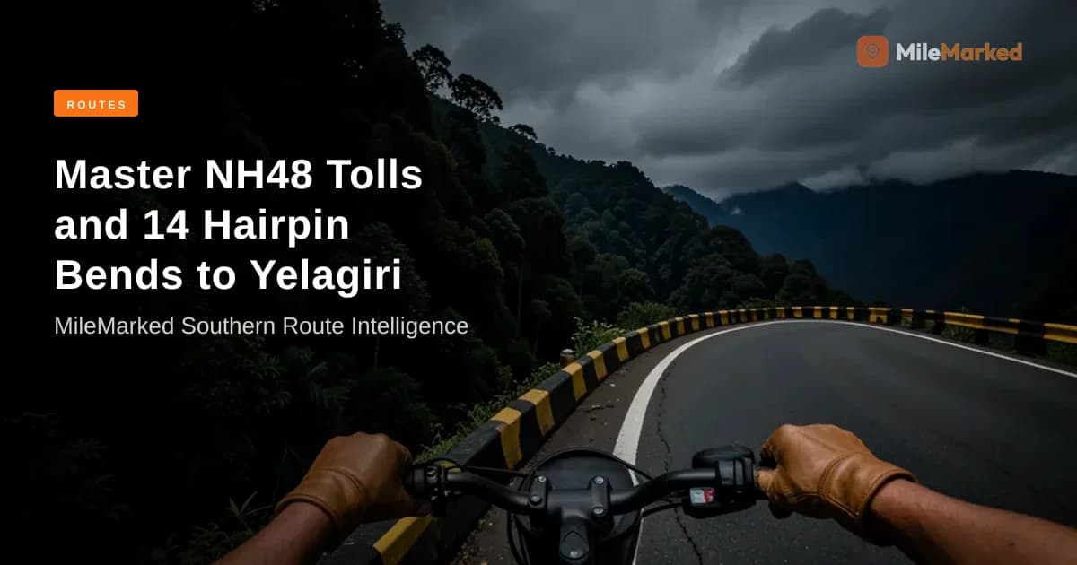
Once you clear Ponneri Junction and pass through the gateway arch at the base of the mountain, the flat highway transforms into a technical hill ride. The Yelagiri 14 hairpin bends motorcycle ride covers 14 kilometres of ascending tarmac that climbs over 800 vertical meters.
       [Athanavur / Plateau Top]
                 |
            (Bend 14 - Sunset Point)
                 |
       (Bends 7 to 11 - S-Curves & RTC Bus Turns)
                 |
       (Bends 1 to 6 - Forest Cover & Monkeys)
                 |
    [Base Gate / Ponneri Junction]
Road Condition & June 2026 Upgrades
Following monsoon soil erosion in early 2026, the Tamil Nadu Road Infrastructure Development Corporation completed a comprehensive restoration of the ghat section in June 2026. High-impact concrete crash barriers and earth-retaining walls now protect all 14 hairpin bends, while fresh asphalt offers consistent friction even when damp.
Hairpin Riding Protocols & Safety Rules
- Gear Selection: Keep your bike in 2nd or 3rd gear during the climb. Dropping to 1st mid-corner causes rear-wheel jerky motion on tight inclines, while holding 4th gear will lug your engine on steep exits.
- The RTC Bus Rule: Government-run Tamil Nadu State Transport Corporation (TNSTC) buses frequent this mountain route. On hairpin bends 7, 9, and 11, these large vehicles require the entire road width to swing their front bumpers around. Always yield the right of way to ascending or descending buses. If you hear a loud horn blast echoing around a curve, stop completely on the outer edge before entering the bend.
- Wildlife Hazards: Bonnet macaques colonize hairpins 2 through 6. Do not keep visible plastic bags or food items strapped loosely to your pillion seat or tank bag. They will jump onto idle motorcycles if you stop for photos near the cliff edge.
CRITICAL FUEL ALERT: There are zero functional fuel stations on the Yelagiri plateau (Athanavur/Mangalam). You must fill your fuel tank completely at the Indian Oil or HPCL outlets located near Ponneri Junction at the base of the hill before starting your 14-km ascent.
[Ponneri Junction Base] ---> (14-km Climb / 14 Bends) ---> [Plateau Top (NO FUEL PUMPS)]
  *LAST CHANCE FUEL!*                                       *Ensure 100% Full Tank*
Complete 2-Day Chennai to Yelagiri Bike Trip Itinerary
This weekend schedule balances open-highway riding with dedicated leisure time on the cool plateau.
Day 1: Highway Cruise, Ambur Feast & The Evening Climb
- 05:45 AM – 06:00 AM: Depart from Kathipara Junction, Chennai. Clearing Sriperumbudur before sunrise saves at least 45 minutes of heavy industrial transit time.
- 08:00 AM (100 km mark): Stop for a light breakfast of hot Podi Idlis and South Indian filter coffee at Kaveripakkam or Wallajahpet highway plazas.
- 10:30 AM (140 km mark): Take an optional 45-minute cultural break at Vellore Fort. Park your bike in the secure public lot directly opposite the moat and stretch your legs along the granite ramparts.
- 01:00 PM (180 km mark): Pull over at the highway outlets in Ambur for a plate of authentic Ambur Mutton Biryani.
- 02:30 PM (216 km mark): Arrive at Ponneri Junction. Top off your fuel tank, check your tire pressures, and begin the 14 km hill climb.
- 03:30 PM: Arrive atop the plateau at Athanavur town. Check into your hotel or resort.
- 05:00 PM – 07:00 PM: Head to Punganoor Lake. Take a quiet stroll around the perimeter pathway or hire a pedal boat. Grab hot spiced corn and local tea from the stalls near the entrance park.
DAY 1:
06:00 AM - Depart Chennai
  ---> 08:00 AM - Breakfast @ Kaveripakkam
  ---> 10:30 AM - Quick stop @ Vellore Fort
  ---> 01:00 PM - Biryani Lunch @ Ambur
  ---> 02:30 PM - Tank Up @ Ponneri Jnc
  ---> 03:30 PM - Reach Yelagiri Plateau
  ---> 05:00 PM - Relax @ Punganoor Lake
Day 2: Peak Treks, Sightseeing & Smooth Return Ride
- 06:30 AM: Start early with a short trek up Swamimalai Peak. Standing at 4,338 feet (1,322 meters), it is the highest point in Yelagiri. The 3 km trail winds through dense foliage and takes roughly 2 to 2.5 hours round-trip, delivering sweeping views of the surrounding valley.
- 10:00 AM: Return to Athanavur for breakfast, shower, and pack up your saddlebags.
- 11:30 AM: Visit the Nature Park near the town center to see the terraced gardens and musical fountain complex before checking out.
- 01:00 PM: Begin the smooth downhill descent along the 14 hairpin bends, keeping your bike in engine-braking gear (3rd gear) to preserve your brake pads.
- 02:30 PM: Rejoin NH48 at Ponneri Junction and head back toward Chennai, stopping for evening tea near Sriperumbudur.
- 07:00 PM: Back at Kathipara Junction in Chennai.
📋 Complete Yelagiri Hills Planning Kit on MileMarked Download the complete, verified route details including day-by-day stops, hotel recommendations, offline maps, and technical riding notes for the Yelagiri Hills weekend trip directly from MileMarked.
Culinary Pitstops & Fuel Refueling Strategy
A great motorcycle trip is as much about the food stops as it is about the tarmac. Route planning between Chennai and Yelagiri offers world-class highway dining options if you time your stops correctly.
[Chennai] === (100 km) ===> [Murugan Idli Shop] === (80 km) ===> [Ambur Star Biryani] === (36 km) ===> [Yelagiri]
                             (Breakfast Stop)                     (Lunch Stop)
Recommended Breakfast Stops (100 km Mark)
- Murugan Idli Shop (Kaveripakkam / Wallajahpet Bypass): Clean rest facilities, safe parking visible from the seating area, and fast service. Order the Ghee Podi Idli accompanied by four varieties of chutney to keep your energy levels steady without feeling sluggish on the bike.
The Ultimate Biryani Lunch (180 km Mark)
- Ambur Star Biryani (NH48 Highway Outlets): Located right on the highway bypass outside Ambur town, this location avoids the congested interior market roads. The short-grain Seeraga Samba rice cooked with soft mutton and subtle wood-fire spices is light on the stomach, preventing afternoon fatigue while riding.
Strategic Refueling Guide
Always use high-volume fuel stations on national highways to ensure clean fuel quality without water contamination.
- First Fuel Window (Chennai Exit): Fill your tank completely at the automated COCO (Company Owned Company Operated) HPCL or IOCL pumps near Sriperumbudur.
- Final Pre-Ghat Refuel (Ponneri Junction): Even if your fuel gauge shows half a tank, stop at the fuel stations near Ponneri Junction directly at the base of SH130. Fill your tank to the brim. Once you climb the hill, there are no retail fuel pumps available across the entire plateau.
What is the Total Budget for a Chennai to Yelagiri Bike Trip?
Planning a predictable budget ensures zero surprises on the road. The detailed expense breakdown below reflects standard 2026 pricing for a single rider on a 250cc–350cc motorcycle over a 2-day, 1-night weekend run.
| Expense Category | Budget Option (INR) | Comfort Option (INR) | Notes / Details |
|---|---|---|---|
| Fuel (460 km total) | ₹750 | ₹1,050 | Assumes 35 km/l at ₹102/liter petrol price |
| Highway Tolls | ₹0 | ₹0 | Two-wheelers exempt on TN National Highways |
| Accommodation (1 Night) | ₹1,200 | ₹2,800 | Budget homestay vs 3-star resort in Athanavur |
| Food & Refreshments | ₹800 | ₹1,400 | Breakfast, Ambur biryani, snacks, and coffee |
| Sightseeing Entry Fees | ₹100 | ₹250 | Punganoor Lake (₹10), Boating (₹50-75), Nature Park |
| Emergency Contingency | ₹500 | ₹500 | Recommended cash buffer for tire repairs |
| Total Estimated Budget | ₹3,350 | ₹6,000 | Per rider (Costs lower when splitting stays) |
Note: Budget figures calculated using real-time highway rates for late 2026.
Best Time to Visit Yelagiri & Seasonal Riding Tips
Understanding the seasonal weather patterns of the Eastern Ghats helps you pack the right riding gear and avoid hazardous road conditions.
NOV - FEB: Peak Season (12°C - 24°C) -- [IDEAL RIDING WINDOW]
MAR - MAY: Summer (22°C - 34°C)       -- Warm Highways, Cool Hill Evenings
JUN - OCT: Monsoon (18°C - 28°C)      -- Slippery Ghats & Fog Hazards
Peak Season: October to February (The Golden Window)
This is the best time to visit Yelagiri on bike. Daytime temperatures on the plateau hover comfortably between 18°C and 24°C, dropping down to a crisp 12°C at night.
- Riding Conditions: Clear high-visibility skies on NH48 and crisp, cool air on the mountain climb.
- Gear Requirement: Pack a breathable mesh riding jacket equipped with a removable thermal or windproof liner for late evening runs around the lake.
Monsoon Season: June to October (Proceed with Caution)
The Northeast Monsoon impacts Tamil Nadu heavily between mid-October and December, while Southwest monsoons affect the region lightly from July to September.
- Hazards: The 14 hairpin bends can experience localized rockfalls, mossy corner edges, and dense fog patches that reduce visibility to under 10 meters near hairpin 10 and above.
- Gear Requirement: Bring a high-visibility, 100% waterproof rain suit, treat your helmet visor with an anti-fog coating, and keep your tire tread depth above 3mm for wet surface grip.
My Stance on Highway Gear for South Indian Summer Rides
There’s a persistent myth among Chennai riders that full motorcycle gear is unmanageable during hot road trips across Tamil Nadu. You'll see riders stripping down to T-shirts as soon as they clear the first toll booth.
I strongly disagree with this approach.
T-shirts offer zero abrasion protection on high-speed tarmac, and direct sun exposure actually dehydrates your body far faster through sweat evaporation than wearing a properly ventilated jacket. On the hot NH48 corridor, I always wear an abrasion-resistant full-mesh riding jacket (like an Knox or Rynox mesh unit) paired with a light, light-colored moisture-wicking base layer underneath. The base layer traps a thin layer of moisture that cools you down as air flows through the mesh fabric, protecting your skin from sun blisters while giving you certified armor protection if gravel sends your bike sliding on an unpaved Sriperumbudur diversion.
Disclaimer: The operational details, toll exemptions, and route conditions mentioned in this guide were verified during rides conducted in 2026. Highway updates, construction schedules, and regional entry fees may change over time.
Ready to ride Yelagiri Hills? Don't leave home without the complete MileMarked planning kit — verified fuel stops, hotel recommendations, break points, and a packing checklist built specifically for this route. Riders who plan with MileMarked data ride smarter and worry less. Visit the Chennai to Yelagiri trip page to download it now. If you'd rather stay on the coast this weekend, our Chennai to Pondicherry ride follows the ECR instead.
About the Author
Parth Kapoor is the founder of MileMarked and has been riding motorcycles across India since 2019. He has personally verified routes from Ladakh to Tamil Nadu, logging over 40,000 km on Indian highways and mountain passes. Parth built MileMarked after getting lost on the Spiti circuit with an outdated itinerary — his mission is to make sure no rider makes the same mistake.
Frequently Asked Questions
How many kilometres is Chennai to Yelagiri by bike?
The distance from Chennai (Kathipara Junction) to Yelagiri Hills (Athanavur) by bike is approximately 230 km. The route follows NH48 past Sriperumbudur, Kanchipuram, and Vellore up to Ponneri Junction, where you take SH130 for the final 14-km hill climb.
Is Yelagiri ghat road safe for two wheelers?
Yes, the Yelagiri Ghat Road is safe for two-wheelers. The 14-km stretch was fully restored with new concrete retaining walls and smooth asphalt. However, riders must maintain controlled speeds (25–35 km/h), stay in lower gears (2nd/3rd gear), and give way to ascending government buses taking wide turns on tight curves.
What is the toll cost and highway condition from Chennai to Yelagiri in 2026?
Two-wheelers are exempt from paying toll fees on Tamil Nadu National Highways (NH48). You can pass freely through the designated extreme-left bike lanes at all toll plazas. As of 2026, NH48 has ongoing 6-laning construction and diversions between Sriperumbudur and Karaipettai, but the road opens up into smooth 4-lane tarmac from Wallajahpet to Ponneri Junction.
Are there petrol bunks available on top of Yelagiri Hills?
No, there are zero working petrol stations on the Yelagiri plateau. Riders must fill up their fuel tanks completely at the fuel stations near Ponneri Junction at the foot of the hill before starting the 14-km ghat climb.
Do I need a high-power motorcycle to ride to Yelagiri?
No, a high-power bike is not required. Any well-maintained 125cc to 150cc motorcycle or modern scooter can climb the 14 hairpin bends easily if ridden in the correct gear. Ensure your brakes, tires, and drive chain are inspected before leaving Chennai.